Before the Freeway
 1861, Nicholas Chevalier")
Image: Studley Park at sunrise (Sunrise on the Yarra) 1861, Nicholas Chevalier. Source: National Gallery of Victoria.
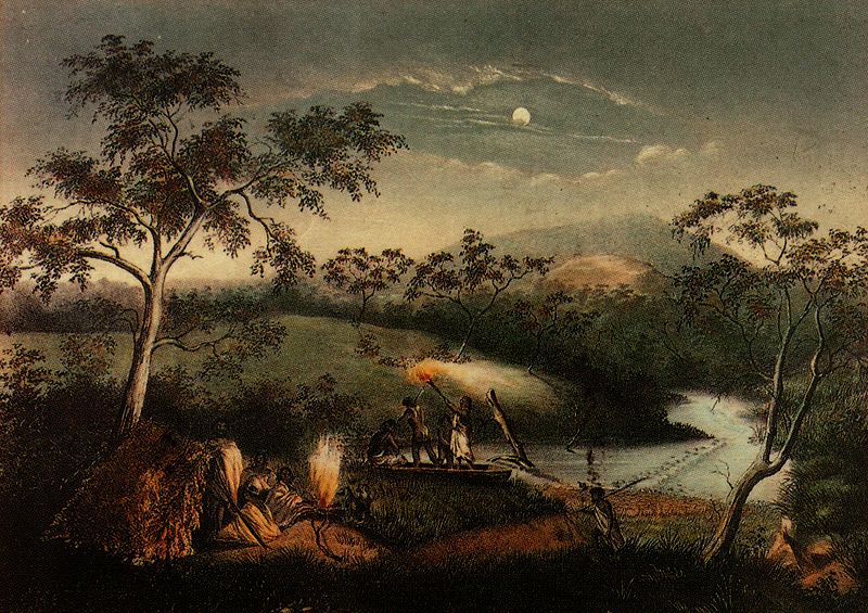
Image: Aboriginal people fishing and camping on Merri Creek. Tinted lithograph by Charles Troedel, 1864 from Souvenir Views of Melbourne and Victorian Scenery. Source: Wikipedia
 Australia.")
Image: Dights Falls, Thomas Clark (c. 1814-1883) Australia. Obviously a long time before the Eastern Freeway altered the local terrain. Source: Australian Art Auction Records.

Image: 1905 – 1910? Postcard of Dight’s Falls. A photo taken from the Studley Park side of the river and showing the mill race and a cluster of buildings including the three storey mill. Various buildings and a smoking chimney can dimly be seen in the background. The island near the mouth of the Merri Creek no longer exists, having been removed as part of the alteration to the Yarra’s course in preparation for freeway construction. Source: Picture Victoria.

Image: 21 October 1908, Opening of the Fitzroy Municipal Baths, opened by Councillor F.R. Chapman, Mayor. The Fitzroy Swimming Pool is located at Alexandra Parade, Fitzroy. Source: Picture Victoria.

Image: Yarra River, APM Mills on Heidelberg Road, Alphington, showing train bridge (now Chandler Highway) and Kew, pre-Eastern Freeway cutting. Source: Darebin Historical Encyclopedia

Image: Railway bridge over Alexandra Parade East down side. Source: PROV Wiki – Public Transport Corporation Photographic Collection

Image: Railway bridge over Alexandra Parade East up side. Source: PROV Wiki – Public Transport Corporation Photographic Collection
 posed at the Deep Rock swimming area above Dight's Falls")
Image: 1918-1920 Deep Rock Swimming Club. Description: A large group of men and boys (many in bathing suits) posed at the Deep Rock swimming area above Dight’s Falls.
The course of the river in this area was altered during freeway construction in the 1970s so that an exact location is difficult to find nowadays, but walkers can see a commemorative plaque. Source: Picture Victoria.

Image: Alexandra Parade was previously named Reilly Street. Short story is, it used to flood, and that’s why there’s a large drain underneath it. Source: Picture Victoria.
Alexandra Parade was a natural water course that flowed into the Yarra River just above Dight’s Falls. Alexandra Parade was known as Reilly Street until it was beautified as a depression work scheme).
Alexandra Parade 1929, from ‘Planting the Nation’ p177 G. Whitehead
Before the Reilly Street drain was built, the street was an open sewer with many small bridges across it.
In 1856-7 The East Collingwood Council began to construct a major open drain along Reilly Street (Alexandra Parade) from Smith Street to the Merri Creek.
It overflowed onto the Collingwood Flat in winter and had to be deepened to ten feet (3m) when the Melbourne City Council began to extend it west.
The Argus, Tuesday 17 August 1886 reported the drain had a catchment of 700 acres in Melbourne, 120 acres in the Borough of Brunswick, 900 in City of Fitzroy and 156 in the City of Collingwood, although the principal flow was between Smith Street and the river.

Image: July 1926, Royal Derby Hotel, corner Brunswick Street and Alexandra Parade, Fitzroy. Note the width of those footpaths. Source: Picture Victoria.

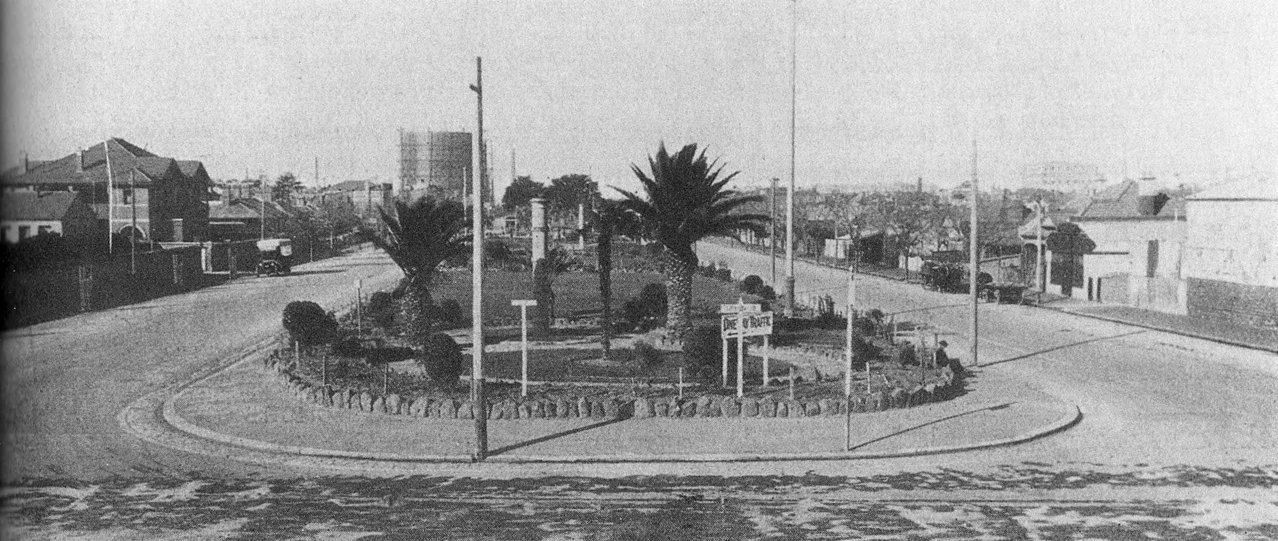
Image: Alexandra Parade, circa 1960s. Looking from Wellington Street along the central reservation in Alexandra Parade, large tree in foreground, children playing on swings on right, shot tower visible through branches of tree. Source: State Library of Victoria.

Image: From the first Melway, F3, Map 44. Trenerry Crescent connected to Groom Street, Lulie Street connected to Rutland Street. Alexandra Parade used to end in a cul de sac near the Yarra River.
9 thoughts on “The Battle for Alexandra Parade”
Comments are closed.
Such a *modern*, progressive-thinking solution this tunnel is eh?
By golly I remember this campaign well.
A couple of incidents stand out as amusing (if any part of this could possibly be called amusing)
1. The police spokesmen on the news condemned the ‘rubbish’ ‘health hazard’ of the barricade we had erected. Meanwhile, outside of their caravan were piles and piles of used tea-bags and boxes of kentucky fried chicken
2. The first car to come down the new freeway (with a police escort) was a Mercedes. Driven by Bob Jane.
I can laugh now
We should also remember the battle in the early 1990s to stop the widening of Alexandra Pde. The Coalition Against Freeway Extensions (CAFE) fought this “upgrade” knowing that the resulting increased traffic volumes would inevitably bring us to the current situation. Many 1977 protesters were involved in the 1994 campaign.
These pages have been updated to now include Citizens Against the Freeway Action (CAF) and Coalition Against Freeway Extensions (CAFE) history, so please don’t hesitate to contact us if you have any additional photos or stories.